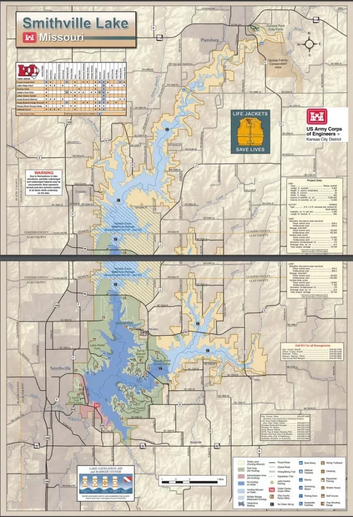
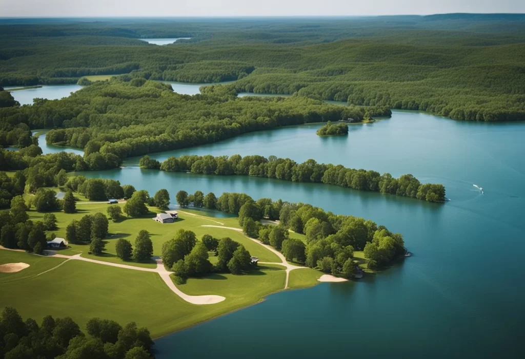
Smithville Lake is a popular destination for outdoor enthusiasts in Missouri. Located in Clay County, it covers more than 7,000 acres, offering various recreational activities like fishing, boating, camping, and hiking. A crucial tool for visitors is the Smithville Lake map.
The map provides a detailed overview of the lake, covering boat ramps, fishing locations, hiking trails, camping sites, and more. Essential for maximizing your time at the lake, this map is also valuable for conservationists and researchers, providing insights into the lake’s ecosystem.
Overview of Smithville Lake

For outdoor enthusiasts in Missouri, Smithville Lake is a go-to spot for fishing, boating, and hiking. The map serves as an essential tool for exploration, offering detailed insights into the lake’s topography, boat ramps, fishing areas, and hiking trails.
Its user-friendly design and comprehensive information make it invaluable for those wanting to make the most of their time at Smithville Lake.
Understanding Smithville Lake Depth Map
Smithville Lake, known for fishing and water activities, requires an accurate understanding of its depth and topography. A Smithville Lake depth map is a valuable tool, displaying the lake’s depth with color coding and contour lines.
Despite variations due to factors like weather and season, the depth map helps identify hazards, fishing hotspots, and plan boating routes, ensuring a safe and enjoyable experience.
Getting to Smithville Lake

Easily accessible from several major highways, Smithville Lake in Clay County, Missouri, welcomes outdoor and water sports enthusiasts.
Routes include I-435 to MO-92 East or I-29 to MO-92 West. Public transportation, like the Kansas City Area Transportation Authority (KCATA) bus service, is also available. Parking areas, like the Sailboat Cove lot, offer convenient access to the lake’s beach and boat ramp.
A Guide to Smithville Lake Fishing Map
As a popular fishing spot, Smithville Lake’s 7,200 acres and a maximum depth of 45 feet attract anglers. A Smithville Lake fishing map is recommended for a fruitful fishing experience, providing information on the lake’s structure, depth contours, underwater features, and fish habitats.
Available in digital and paper formats for its size, anglers use the maps identify the best fishing spots, underwater structures, and suitable bait and tackle.
Frequently Asked Questions
What is the depth of the deepest part of Smithville Lake?
The deepest part of Smithville Lake is approximately 60 feet deep. The lake has an average depth of 23 feet, making it a popular destination for fishing and boating enthusiasts.
How many boat ramps are available at Smithville Lake?
There are a total of four boat ramps available at Smithville Lake. These ramps are located at Little Platte Park, Camp Branch Marina, Sailboat Cove, and Old Town Park. Boaters are encouraged to use caution and follow all posted rules and regulations when launching their boats.
What are the rules for using Smithville Lake?
There are several rules and regulations in place for using Smithville Lake. These include restrictions on swimming in certain areas, speed limits for boats, and guidelines for fishing and hunting. Visitors are encouraged to familiarize themselves with these rules before visiting the lake to ensure a safe and enjoyable experience.
Visitors to Smithville Lake are encouraged to explore the Litton Visitor Center, enjoy nearby cities, and discover the Platte River’s beauty. Operated by the Army Corps, Smithville Lake’s shoreline offers a picturesque setting. For more details, contact the Congressman Grayson or the state office using the provided phone number.
With its serene ambiance and a number of lakes in the vicinity, Smithville Lake primarily serves as a haven for outdoor activities. Whether you’re a fishing enthusiast or someone seeking a peaceful retreat, Smithville Lake offers a memorable experience.